As is typical for this time of year, temperatures are currently on a bit of a rollercoaster. After last week's cool phase, the pendulum is now swinging in a mild/warm direction and April 2024 is saying goodbye to early summer. Saharan dust has a somewhat dampening effect. This will be washed out again by rain showers in the second half of the week...

Early summer April finale
April 2024 began unusually warm, but then turned out to be unusually cool for a long time. Today's finale saw early summer temperatures in many parts of the country, with only the west lagging somewhat behind. It was warmest in Bad Ragaz at 26.6 degrees, ahead of Altenrhein at 26.4 degrees. In the Alps, the Föhn was blowing, but in some places it reached as far as the lowlands. It is blowing again tonight in Zurich, for example.

Fig. 1: Maximum temperatures on April 30, 2024; Source: MeteoNews, Ubimet
Highest temperature (as of 16:50)
| Measuring stations | Highest temperature (in °C) |
|---|---|
| Bad Ragaz (496 a.s.l., SG) | 26.6 |
| Altenrhein (398 a.s.l., SG) | 26.4 |
| Würenlingen (334 a.s.l., AG) | 26.2 |
| Oberriet (420 a.s.l., SG) | 25.8 |
| Beznau (325 a.s.l., AG) | 25.6 |
| Tänikon (536 a.s.l., TG) | 25.6 |
| Mosen (453 a.s.l., LU) | 25.2 |
| Schaffhausen (438 a.s.l., SH) | 25.1 |
| Bischofszell (506 a.s.l., TG) | 25.1 |
| Zurich-Reckenholz (443 a.s.l., ZH) | 25.1 |
| Leibstadt (341 a.s.l., AG) | 25.1 |
| Zurich Airport (436 a.s.l., ZH) | 25.1 |
| Buchs-Aarau (387 a.s.l., AG) | 24.9 |
| Hallau (419 a.s.l., SH) | 24.8 |
| Gösgen (380 a.s.l., SO) | 24.7 |
| Zurich-Zurichberg (556 a.s.l., ZH) | 24.6 |
| Wädenswil (463 a.s.l., ZH) | 24.6 |
| Chur (555 a.s.l., GR) | 24.6 |
| Galgenen (468 a.s.l., SZ) | 24.5 |
| Basel-Binningen (316 a.s.l., BL) | 24.2 |

Fig. 2: Peak gusts on April 30, 2024; Source: MeteoNews, Ubimet
High clouds and sun, showers in the west
The new week will begin for most people with a friendly mix of high cloud and sometimes more, sometimes less translucent sunshine. It will also be a little hazy due to Sahara dust. Clouds will be more present in the west and north-west, with a few showers passing through from the south-west from time to time, especially along the Jura (although the main focus will be over France). Temperatures will reach highs of around 20 degrees in the afternoon, with the east warmer than the west. In the Alps, it will only be slightly foehn-like.

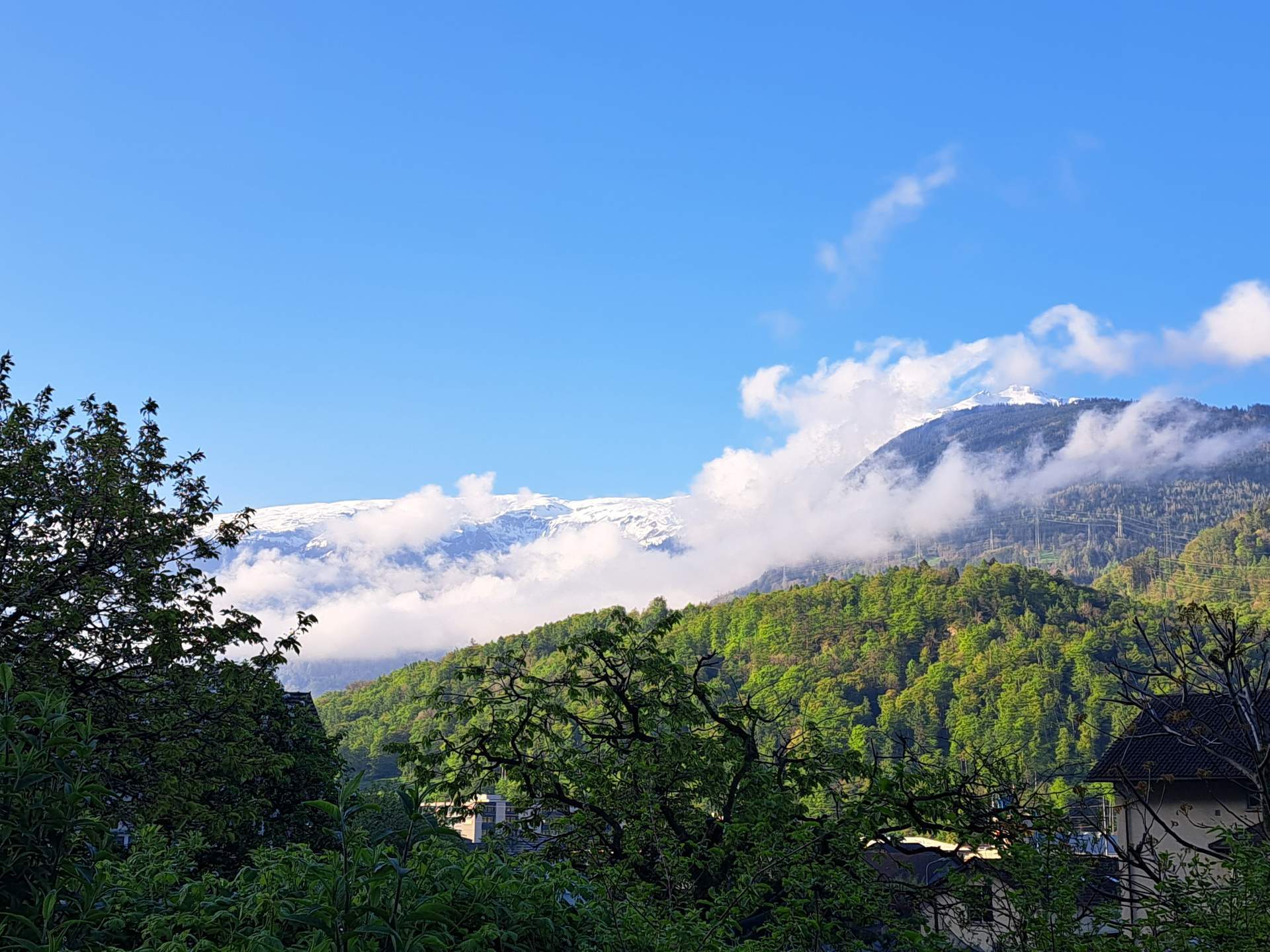
Fig. 1: View from the Pizol into the foehn-laden Sarganserland; Source: foto-webcam.eu
Warmer and more foehn in the Alps
Tomorrow, Tuesday, we can expect a similar picture. In the morning, it will generally be quite sunny with veil clouds, but these could be somewhat more extensive due to the Sahara dust. The sky is not really blue. In the afternoon, the high and medium-high clouds will become more numerous and more extensive, and the sun will have a harder time in the west than in the east. It will also tend to get cloudy in the south, along the Alps there will be the first precipitation with snow only above 2400 to 2500 meters. Compared to today, temperatures will continue to rise, especially in the eastern half of the country it will be warm in early summer at 23 to 24 degrees. In the Alps, the Föhn wind will revive and, with its support, 25 to 26 degrees will be possible in the Rhine Valley. The zero degree line will rise to 3300 to 3500 meters, with strong southerly winds blowing on the mountains.

Fig. 2: Weather tomorrow Tuesday – warm with foehn and Sahara dust; Source: MeteoNews
Foehn and warm, rain in the south
The air pressure will continue to drop on Wednesday. In central and eastern Switzerland it will still be comparatively friendly, with patches of cloud and sunshine sharing the sky. It will be pleasantly warm, with a strong Föhn wind blowing in the Alps. In the Rhine Valley, the summer mark of 25 degrees will probably be reached once again. In the west, the clouds will thicken during the day and the risk of showers will gradually increase. As recently, it will also be a few degrees cooler here. In the south, it will be cloudy and wet at times.
Showers and thunderstorms, plus freshening winds
On Thursday, we will be under the influence of a low pressure system centered over southern Germany. In the west and south, it will be very cloudy all day and repeatedly wet. In the east, there will be some clearing and dry spells in the morning, but then heavy downpours and even thunderstorms are to be expected here too. The south-westerly wind will freshen and temperatures will fall. In French-speaking Switzerland, temperatures will only reach around 12 degrees.
Cloudy and occasionally wet, north foehn in the south
Friday will be cloudy and occasionally wet in the north, with the snow line varying between 1200 and 1500 meters. The precipitation will ease during the day, with clearing in the evening. Compared to the first few days of the week, it will be significantly cooler. The south will be somewhat more favorable due to the north foehn.

Fig. 3: Outlook for the coming days; Source: MeteoNews
The development at the weekend is still somewhat uncertain and depends on the position of the low pressure system. From today's perspective, Saturday will be mostly dry with variable cloud cover; in the south it will be quite sunny and still foehn. On Sunday, the signs are currently pointing to more precipitation.
disclaimer
The content of this article has been at least partially computer translated from another language. Therefore, grammatical errors or inaccuracies are possible. Please note that the original language version of the article should be considered authoritative.