The weather is still showing its dynamic side today and tomorrow. However, behind tomorrow's cold front, we will increasingly enter a calmer and high-pressure dominated phase. While the issue of high fog and mist will be back on the agenda on the Swiss Plateau, super winter sports conditions will prevail at higher altitudes with often sunny conditions.

Cloudy and wet in the east, friendlier in the west
Today's Thursday will initially show its often wet side in the eastern midlands, with snow falling from around 1800 to 2000 meters. During the day, it will dry out increasingly from the west, but in the very east, the last showers will still be possible in the evening and during the coming night. While there will be more sunny spells in the west during the day, clouds will dominate in the east with only a few clearings. Compared to the record mild Wednesday yesterday, the highs will not quite reach the same level, but at 11 to 13 degrees it will remain exceptionally mild for the end of January. It's not just mild, but almost warm on the southern side of the Alps today. With plenty of sunshine and the support of the north foehn, the first "20s" of the year could well fall.

Fig. 1: View of the precipitation radar this morning; Source: MeteoNews
Cold front on Friday
Tomorrow, Friday, will be variably cloudy in the first half of the day, with a few clear spells, especially in the mountains. From around midday, the cloudiness will increase in the run-up to a cold front. This front will pass over Switzerland during the afternoon. The snow line will initially be a good 2000 meters and will fall to around 1200 meters during the following night as it gradually dries out. With south-westerly to westerly winds freshening up quickly for a while, highs will again reach almost double figures. The south will continue to enjoy favorable weather under the protection of the Alps. Despite the occasional high clouds, it will be quite sunny here and, at a good 12 degrees, a touch milder than in the north.
High fog on Saturday, fog on Sunday
After Friday's cold front, Saturday will begin with widespread residual high fog in the Swiss Plateau. The upper limit will be between 1000 and 1300 meters, although we can't necessarily speak of a compact blanket. During the day, the gray should clear for the most part, but you may need a little more patience in some areas. Temperatures will reach between 5 and 8 degrees depending on the resolution. Above and outside the high fog zones, it will be mostly sunny despite a few high clouds. Once again, great winter sports conditions will prevail in the mountains. With a light wind, around 2 degrees will be measured at 2000 meters.
On Sunday, there will be widespread fog over the lowlands. This will dissipate at least partially during the course of the day, but it will probably not disappear completely everywhere. Above this, there will again be plenty of sunshine, with some high cloud fields moving through from the west towards the afternoon. In the persistent foggy regions, temperatures will barely exceed 3 to 5 degrees, otherwise it could be up to 8 degrees. At higher altitudes, on the other hand, it will be extremely mild, with the zero degree line rising to over 3000 meters during the day. Due to the dry air masses at high altitudes, – one will continue to enjoy excellent visibility, similar to Saturday –.

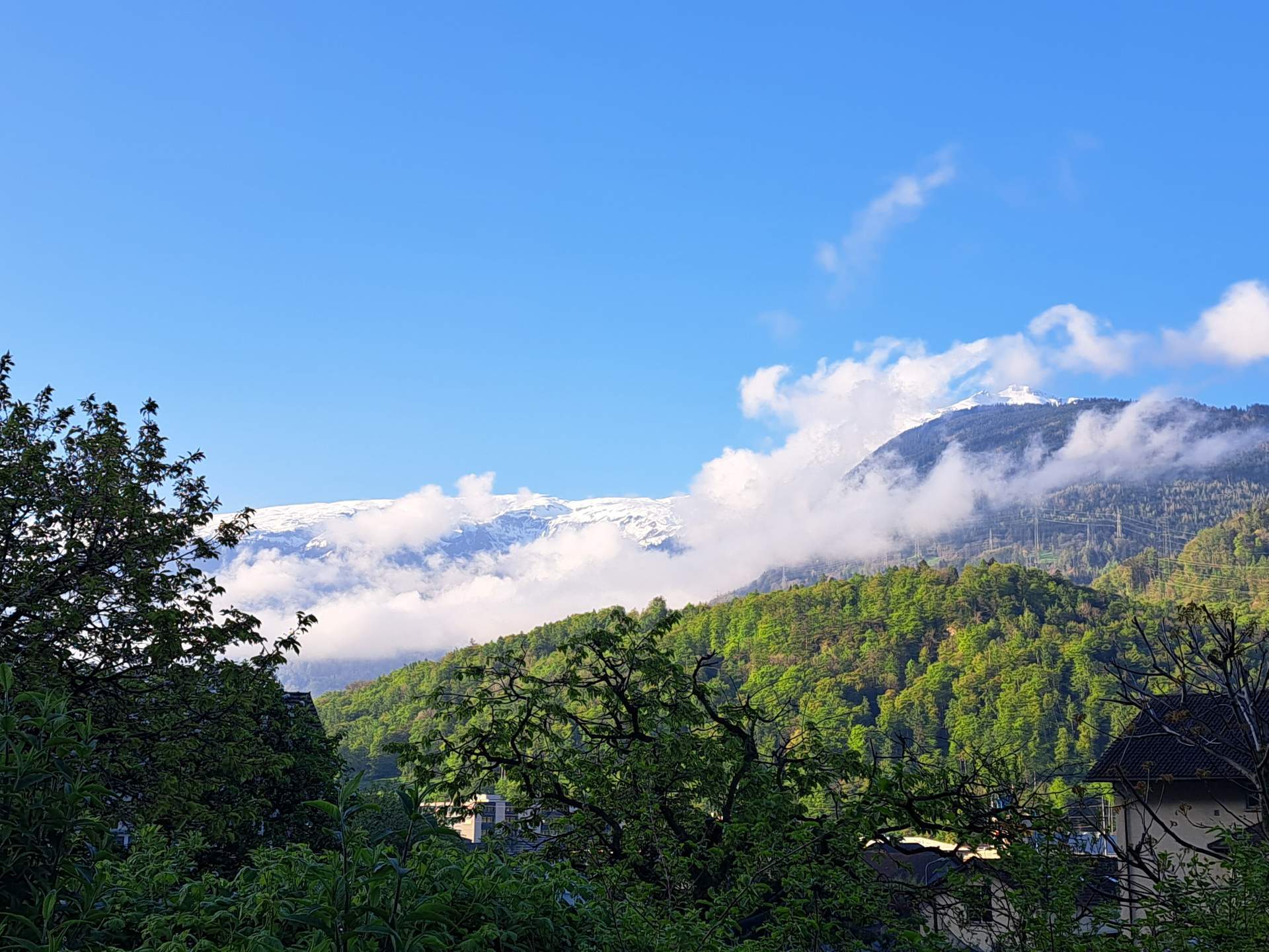
Fig. 2: This is roughly how the conditions are likely to be at the weekend; Source: Roundshot
Less spectacular start to the week
On Monday and Tuesday, the weather will generally be characterized by high pressure. In the mountains, it will be quite sunny apart from occasional extensive medium and high clouds. On the Swiss Plateau, however, fog patches are likely to persist, at least in the morning hours. However, there is a good chance of clearing during the day. Depending on the model, a weak disturbance is to be expected on Wednesday. At a good 8 to 10 degrees, the last days of January will also be too mild. The zero degree line will be extremely high, especially on Monday at around 3300 meters, dropping to around 2600 meters by Wednesday.
")
Fig. 3: Course of the zero degree line from Sunday to Wednesday (upper line); Source: MeteoNews/UBIMET
disclaimer
The content of this article has been at least partially computer translated from another language. Therefore, grammatical errors or inaccuracies are possible. Please note that the original language version of the article should be considered authoritative.