One of the mildest winters on record and the exceptionally mild spring so far are having an impact on nature: as has often been the case in recent years, it has awoken very early and is currently two to four weeks ahead of the rest of the year. Winters are becoming milder and milder as a result of climate change, which means that nature is waking up earlier and earlier and the growing season is being extended. This has a variety of effects, both positive and negative. In particular, the risk of late frosts causing damage is increasing. The next few days will be tricky in this respect.

Preliminary damage assessment
In Switzerland, damage to fruit crops and vines has been reported in some areas, particularly in the Geneva, Valais and Schaffhausen regions. According to an initial estimate by Schweizer Hagel, this is likely to have caused millions in damage. In addition, crops close to the ground such as flowering strawberries are also likely to have suffered some damage. Not only the frost, but also the snow caused damage to arable and grassland crops, with rapeseed, grassland and cereal crops particularly affected by snow pressure damage (especially broken blades of grass). However, the exact extent of the damage will only become clear in the coming days and weeks. However, we were not as badly affected as Germany, for example; according to the Vereinigter Hagel Deutschland insurance company, damage to vines and orchards across Germany is expected to exceed half a billion euros!
Night to Friday: Light frost locally, especially in the east
It was clear for a long time last night, especially in the east, so that temperatures dropped to slightly below zero locally. In addition, there was widespread ground frost with local temperatures below -4 degrees, which also affected some wine-growing regions (Valais, Schaffhausen, Weinland, Rhine Valley, see the following two tables).
Lowest temperature (<700m, as of 06:10)
| Lowland stations | Lowest temperature (in °C) |
|---|---|
| Ebnat-Kappel (620 a.s.l., SG) | -1.9 |
| Schiers (660 a.s.l., GR) | -1.7 |
| Bischofszell (506 a.s.l., TG) | -1.5 |
| Pfäffikon ZH (540 a.s.l., ZH) | -1.4 |
| Giswil (475 a.s.l., OW) | -1.0 |
| Zurich Airport (436 a.s.l., ZH) | -0.9 |
| Tänikon (536 a.s.l., TG) | -0.8 |
| Mosen (453 a.s.l., LU) | -0.7 |
| Würenlingen (334 a.s.l., AG) | -0.5 |
| Hallau (419 a.s.l., SH) | -0.4 |
| Visp (640 a.s.l., VS) | -0.4 |
| Zurich-Reckenholz (443 a.s.l., ZH) | -0.2 |
| Meiringen (589 a.s.l., BE) | -0.1 |
| Güttingen (440 a.s.l., TG) | 0.1 |
| Schaffhausen (438 a.s.l., SH) | 0.3 |
| Altdorf (449 a.s.l., UR) | 0.4 |
| Oberriet (420 a.s.l., SG) | 0.5 |
| Egolzwil (522 a.s.l., LU) | 0.6 |
| Glarus (515 a.s.l., GL) | 0.7 |
| Gösgen (380 a.s.l., SO) | 0.8 |
Lowest temperature 5cm from the ground (<700m, as of 06:10)
During the course of the night, increasingly dense clouds moved in from the west, causing temperatures to rise again somewhat and reducing the ground frost. In the Alpine valleys, there was also some foehn wind in places, which helped to prevent temperatures from dropping any further.
But now it's over, it will be milder in the coming days, so frost is no longer an issue.
Conclusion of the cool phase
Since yesterday, a week ago, there has been very occasional air frost in the lowlands and in the deep Alpine valleys (see Fig. 1, for example 4 frost days in Bern and 3 in Geneva ) as well as repeated ground frost down to below -5 degrees in some places.
 in April (excluding last night)")
Fig. 1: Number of frost days (minima below 0 degrees) in April (excluding last night); Source: MeteoNews, UBIMET
Damage to fruit crops and vines has been reported in some areas, particularly in Valais, western Switzerland and Schaffhausen. In addition, crops close to the ground such as flowering strawberries are also likely to have suffered some damage. However, the exact extent of the damage will only become clear in the coming days and weeks.
Wednesday morning: Light frost, especially on the northern edge and in the west
Last night, it cleared up a little in places, especially on the northern edge, at the southern foot of the Jura and in western Switzerland, so that temperatures dropped into the light frost range in places. With the exception of most of the Alpine valleys, where the cloud cover mostly remained closed, ground frost was also recorded quite widely, locally below -4 degrees, in Basel-Binningen it was even -5.3 degrees and in Fahy in the Jura -6.8 degrees (see the following two tables).
Lowest temperature (<600m, as of 06:00)
| Lowland stations | Lowest temperature (in °C) |
|---|---|
| Grenchen (430 a.s.l., SO) | -1.5 |
| Payerne (490 a.s.l., VD) | -1.3 |
| Möhlin (308 a.s.l., AG) | -1.0 |
| Cressier (432 a.s.l., NE) | -0.9 |
| Mathod (435 a.s.l., VD) | -0.9 |
| Hallau (419 a.s.l., SH) | -0.9 |
| Delémont (439 a.s.l., JU) | -0.8 |
| Bern (565 a.s.l., BE) | -0.8 |
| Stabio (353 a.s.l., TI) | -0.8 |
| Wynau (422 a.s.l., BE) | -0.5 |
| Geneva (420 a.s.l., GE) | -0.5 |
| Koppigen (484 a.s.l., BE) | -0.4 |
| Mosen (453 a.s.l., LU) | -0.4 |
| Würenlingen (334 a.s.l., AG) | -0.3 |
| Egolzwil (522 a.s.l., LU) | -0.2 |
| Bern-Belpmoos (510 a.s.l., BE) | 0.0 |
| Mühleberg (483 a.s.l., BE) | 0.1 |
| Zurich-Reckenholz (443 a.s.l., ZH) | 0.2 |
| Leibstadt (341 a.s.l., AG) | 0.3 |
| Basel-Binningen (316 a.s.l., BL) | 0.4 |
Lowest temperature 5cm from the ground (<600m, as of 06:00)
Late frost damage to vines
Following repeated reports of frost damage to vines over the last few days, particularly in western Switzerland and Valais, last night was particularly tricky in the vine-growing areas of the canton of Schaffhausen, with temperatures in Hallau reaching -0.9 degrees at 2 meters above ground level and -4.8 degrees at 5 centimetres above ground level. At temperatures of around -1 degrees and below at the level of the shoots (approx. 1 meter above the ground), frost damage must be expected. This temperature threshold was clearly undercut at the Hallau measuring station. At such temperatures, without appropriate protective measures (e.g. frost candles), it is to be expected that green shoot parts will partially freeze, first become limp and then brown-black and finally dry out (see Fig. 1).

Fig. 1: Late frost damage to vines; Source: wikipedia
The larger vineyards in the Rhine Valley and on Lake Zurich, on the other hand, came through the night well; here the cloud cover remained mostly closed, so there was no frost and, in most cases, no ground frost.
Not only from parts of Switzerland, but also from France, Germany, Austria and South Tyrol, there are increasing reports of frost damage to vines due to the exceptionally warm weather in March and April and the much more advanced development than usual.
Two more tricky nights
It will be cold again tomorrow night (Thursday) and the night after tomorrow (Friday), with frost expected locally and, especially in German-speaking Switzerland, quite heavy frost on the ground in some parts of the clear night into Friday. This is not the end of the story for farmers...
Monday morning: Another light frost in places, widespread ground frost
Overnight on Monday, temperatures dropped into the light frost range at low altitudes, especially in the west, with temperatures falling below -1 degrees in places. In addition, there was widespread ground frost to locally below -4 degrees, in Neuchâtel even below -5 degrees (see the following two tables and Fig. 1).
Lowest temperature (<700m, as of 06:40)
Lowest temperature 5cm from the ground (<700m, as of 06:40)

Fig. 1: In Neuchâtel there were temperatures below -5 degrees on the ground last night; Source: roundshot
More tricky nights until Friday
Minimum temperatures around 0 degrees or slightly below and ground frost are also expected in the coming nights until Friday, although the west is somewhat more at risk of frost than the east, as it tends to clear up here. The frost situation for crops close to the ground as well as for orchards and vineyards will therefore remain somewhat tense.
Temperatures around freezing point in the morning until Thursday
The coming days are quite tricky in terms of frost in the morning. However, there will be a lot of clouds during the nights and at the beginning of the week some breezes, so that temperatures in the lowlands and in the deep Alpine valleys should be around or slightly above freezing at 2 meters above the ground in the weather huts, with very local temperatures below freezing possible at most. Directly on the ground, on the other hand, some frost is to be expected with even brief clearings, so crops close to the ground should continue to be protected. A positive aspect for fruit trees and vineyards is that there will be no nights with clearly negative temperatures at 2 meters above ground level, so any frost damage should be limited. With the very cool air mass that has flowed in, this is anything but a matter of course; a partially clear night would have been enough for temperatures to drop significantly into the minus range!
Friday morning: quite widespread ground frost, partly some hut frost
It cleared up a little overnight today (Friday), so that temperatures dropped to 5 centimetres below freezing in some places, especially directly on the ground (see table below).
Lowest temperature 5cm from the ground (<600m, as of 06:10)
In some places, temperatures dropped below -2 degrees, locally even below -5 degrees, in Sion it was even -6 degrees (see Fig. 1 and 2).

Fig. 1: In Sion, there was quite heavy frost on the ground during the night, which is easily recognizable by the frost; Source: roundshot

Fig. 2: There is also some frost in Bern in the morning; Source: roundshot
In addition, there was also some hut frost (temperature at 2 meters above ground) in some areas, especially in the west, as the table below shows the lowest temperatures of the past night.
Lowest temperature (<600m, as of 06:10)
With such temperatures on the ground, it is to be expected that some of the flowers of unprotected strawberries and unprotected lettuce and vegetable seedlings planted outdoors will freeze. Locally, especially in the west, it is also possible that blossoms and small fruits of fruit trees and vines have been damaged. However, there is unlikely to have been any major damage, as the temperatures were not quite low enough for this.
Some risk of frost again, especially overnight into Monday
Tomorrow night, Saturday, and Sunday will be less frost-prone due to lots of clouds and repeated precipitation, despite the air mass remaining very cool. In the night to Monday, some weather models are forecasting clearing in the swiss plateau and thus a slightly increased risk of frost. Depending on the weather model, Tuesday night will also be slightly tricky. MeteoNews will keep you up to date.
First half of spring around 3 degrees too mild
The first half of the meteorological spring (March to May) was exceptionally mild, with an excess of around 3 degrees compared to the long-term average for 1991 to 2020 across the whole of Switzerland (see Fig. 1).

Fig. 1: Temperature deviation so far in spring compared to the long-term average 1991-2020; Source: MeteoNews, UBIMET
Large vegetation lead continues
The vegetation lead of around 2 to 4 weeks, which was already present at the beginning of spring, has thus been maintained. Full spring has already begun with the flowering of lilacs and apple trees, which is normally the case around the end of April/beginning of May (see the phenological calendar below and Fig. 2).

Fig. 2: In Sarganserland, the apple tree blossom is already largely over; Source: Bild: Roger Perret
Increased risk of frost in the next few days
This week and probably also next week, we are in the area of high polar air, the temperatures are clearly lower than usual at this time of year(see here). This means that there is a risk of ground frost (5 centimeters above the ground) and, in some areas, hut frost (2 meters above the ground) on clear nights with little wind. This week, the nights on Thursday in the Chur Rhine Valley and Sarganserland and the night on Friday in the western Mittelland are particularly dangerous (see Fig. 3 and 4).

Fig. 3: Expected minimum temperatures in the night to Thursday; Source: MeteoNews, UBIMET

Fig. 4: Expected minimum temperatures in the night to Friday; Source: MeteoNews, UBIMET
What is at risk of frost and when?
Currently, ground crops such as flowering strawberries (see Fig. 5) are particularly at risk of frost. They should definitely be protected with fleece or a tunnel, for example.
")
Fig. 5: The strawberries are currently in bloom (picture from Sarganserland); Source: Bild: Roger Perret
Vines, whose development is also much more advanced than normal, are also at risk with temperatures already slightly below zero. The leaves have already unfolded and the shoots (inflorescences) are visible (see Fig. 6). The problem is that the temperature at the height of the leaves and flowers is somewhat lower than 2 meters above the ground, so it may well be that the temperature at 2 meters is around 0 degrees, but at the height of the leaves and flowers it is damagingly below zero.
")
Fig. 6: The development of the vines is also well advanced (picture from Sarganserland); Source: Bild: Roger Perret
According to Fig. 3, the Chur Rhine Valley and Sarganserland in particular are at risk of frost in the vineyards on Thursday night.
Many fruit trees at low altitudes have already faded, especially apricots, peaches, plums, pears (see Fig. 7) and cherries. Some of the apple trees are still in bloom. Open blossoms are the most vulnerable to frost, while the small fruits can withstand somewhat heavier frost. This means that frost damage is most likely to occur in apple crops, especially in low-stem crops, as the blossoms and fruit set are closer to the ground than in high-stem crops. According to Fig. 4, the western midlands are particularly at risk on Friday night, with temperatures of below -2 degrees calculated at 2 meters above ground level. Here are some ways to protect crops from frost.
")
Fig. 7: Small fruits with pears (picture from the Sarganserland); Source: Bild: Roger Perret
The night into Saturday will be less frost-prone due to wind and recurring showers. However, the risk of frost is expected to increase again afterwards. MeteoNews will provide ongoing information here.
2023/2024 one of the mildest winters since start of measurements
The meteorological winter of 2023/2024 (December to February) will go down in the weather books as one of the mildest on record, with a current deviation of 2.6 degrees from the long-term average of 1991 to 2020 across the whole of Switzerland (see Fig. 1).

Fig. 1: Temperature deviation of current winter compared to the long-term average 1991-2020; Source: MeteoNews, UBIMET
The mildest winter since measurements began in 1864 was the winter of 2019/2020 with a deviation of 2.7 degrees. We will probably fall just short of this, but we will probably reach the second mildest 2006/2007 with a deviation of 2.45 degrees (more on this soon in the winter review).
Winter increasingly mild
A look at the winter temperatures since 1864 shows that winters are becoming increasingly milder; since the end of the 1980s, the red bars with a focus on the last few years have increased significantly (= positive deviation from the 1991-2020 average, see Fig. 2).

Fig. 2: Development of winter temperatures in Switzerland since 1864; Source: MeteoStats - Schweizer Klimastatistiken nach Daten von MeteoSchweiz
Ever earlier spring
Nature is responding to increasingly mild winters on average and is waking up earlier and earlier from hibernation. This can also be seen if you look at nature's calendar, the phenological calendar. In this calendar, the onset times of characteristic phenomena, in the case of plants the characteristic growth stages, are observed and recorded. The phenological calendar divides the year into a total of 10 seasons (see Fig. 3).

Fig. 3: Phenological calendar of Switzerland with the corresponding pointer types; Source: MeteoNews
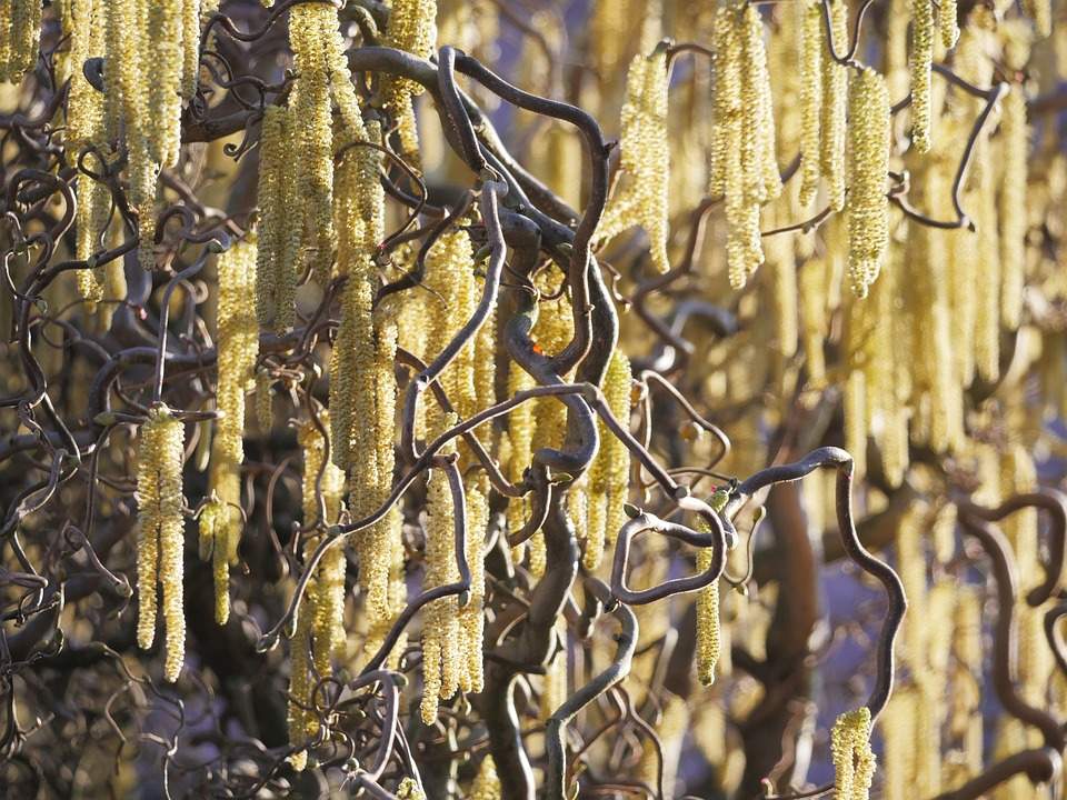
After the winter dormancy, early spring begins with the flowering of hazelnuts, snowdrops and crocuses, usually around mid-February. This year, however, the hazelnut usually began to flower more strongly in the second half of January, which was also reflected in increased symptoms in hay fever patients allergic to hazel (see here). How the plants develop depends mainly on the prevailing temperatures. As soon as it is warm enough, they ramp up their systems, form flowers or begin to sprout leaves. The fact that plants are ending their winter dormancy earlier and earlier is a direct reaction to the rising winter temperatures. The long-term phenological measurement series are therefore an important indicator of climate change and make its local effects clear. According to long-term phenological studies by MeteoSwiss, the hazel blossom has shifted forward by more than two weeks since the 1950s and with it the early spring. Not only does early spring begin earlier and earlier on average, but also the other two spring phases (first spring and full spring). MeteoSwiss calculates the so-called spring index, which uses ten phenological phases (e.g. hazel blossom, horse chestnut leaf development, dandelion blossom, etc.) to show the timing of vegetation development in spring as a deviation in days from the long-term average 1991-2020 (see Fig. 4).

Fig. 4: Spring index, shown as deviation in days from the 1991-2020 average (light green earlier start than normal, dark green later start); Source: MeteoSchweiz
A comparison of Figs. 2 and 4 shows that the spring index correlates very well with winter temperatures; mild winters generally correlate with early vegetation development and, conversely, cool winters with late development.
Particularly advanced vegetation development this year
This year, vegetation development is particularly advanced due to the exceptionally mild first half of February. In addition to snowdrops, spring knot flowers and crocuses, the first daffodils are already blooming in gardens and parks and the first dandelion flowers can be seen in the meadows (see Figs. 5 and 6). Normally, the daffodils bloom in March and the dandelions do not bloom until April (although it must be said that of course only a few dandelions are currently in bloom, they will not bloom en masse until much later).

Fig. 5: First dandelion flowers currently in Sarganserland; Source: Bild: Roger Perret

Fig. 6: First daffodils in bloom in Sarganserland; Source: Bild: Roger Perret
Effects of ever earlier vegetation development
The increasingly earlier vegetation development on average in spring has a variety of effects, both positive and negative. Positive effects can result from the extension of the growing season for agriculture, particularly for vegetable and to some extent also for cereal, berry and fruit cultivation. For example, raspberries and blackberries, which continue to produce new fruit, benefit from a longer growing season, while strawberries and cherries also often benefit from an earlier start to the harvest on average, as consumers can be supplied with the coveted local produce earlier. In addition, the higher average temperatures enable the cultivation of new heat-loving crops. Examples of this are soybean cultivation and the cultivation of later varieties of maize or the cultivation of heat-loving fruits such as kiwis, olives or persimmons.
However, the positive aspects are also offset by manifold negative effects. In addition to increased hay fever symptoms, the ever more advanced vegetation development in spring also increases the risk of late frost, especially for fruit trees and vines, and protective measures are becoming increasingly necessary (see Fig. 7).

Fig. 7: Crown irrigation against late frosts on fruit trees is becoming increasingly necessary; Source: certiseurope.de
Fruit trees that flower earlier and earlier can also remain fruitless if the insects that pollinate them hatch later. Vegetable growers also have to contend with late frost problems. Although they can sow earlier, they often have to protect their crops from the cold with fleece or tunnels. In addition, pest pressure also increases; cold winters usually reduce this, while mild winters allow more pests to survive the winter.
The overall impact of the extended growing season on ecological relationships is difficult to assess. Some species are very adaptable and can cope with many conditions as generalists, while other species are less adaptable and are displaced. In addition, there are often invasive, alien species that could adapt quickly and thus displace native species. Overall, major changes in flora and fauna must be expected.
disclaimer
The content of this article has been at least partially computer translated from another language. Therefore, grammatical errors or inaccuracies are possible. Please note that the original language version of the article should be considered authoritative.